At another site the Commission’s staff had simply added a
few deeper JCB gouges to another pool. These refuges were full of beetles and
waterboatmen, hanging on for when the rains returned, although, knowing water
beetles and waterboatment, the rains better not be too long coming or else they’ll
all have eaten each other.
Nothing fancy or complicated but simple habitat
creation and above all a willingness to try

Druridge Bay, an eight mile arc of sand running north from Cresswell to the harbour of Amble in Northumberland, strewn with wetlands. From lagoons stained the deepest green by summer algae to flooded tyre ruts, glinting water in the arable fields. This blog is a snapshot of research at the University of Northumbria as we explore this pondscape forged between northern sea and sky.
Tuesday, 14 April 2015
Pond creation made to look easy (because it is)
Tuesday, 7 April 2015
The Blakemoor pondlife ideal home exhibition
Loss of habitat is one of the main threats to our wildlife.
Mostly the loss is not intended to hit the species involved but simply the
result of how we use and re-use the landscape. Habitat recreation can be
tricky. Ancient woodland is impossible without a time machine and most landscapes
take time and expertise: reed cutters, hardy sheep, nest creation.....It's all a lot of effort. However ponds are just about the easiest habitat there is,
something anyone can do. Much of the advice that used to worry would be pond
diggers turns out to be not essential. Once upon a time it seemed that ponds
always have to be large and deep, over 1 metre certainly so frogs didn’t
freeze, and with stepped edges like an inverted Mayan temple to make sure you
got all the different plant zones.
Thankfully most of these problems turn out to be myths, well
and truly nailed by Pond Action (now the Freshwater Habitats Trust. They have
lots of excellent information and advice at http://www.freshwaterhabitats.org.uk/habitats/pond/).
Shallow, temporary, small ponds do very well for many plants and animals,
although fish may be the exception. Good water quality certainly helps, and also
ponds created in clusters so you get a bit of variety. It is surprising just
how varied adjacent ponds can become. Nor do you have to worry about getting
the ponds planted up. They will colonise rapidly and over doing the planting can
miss out the earlier pioneer stages as beetles and bugs explore the new
opportunities. Given how easy it is to create new ponds and how rich they are
in wildlife it is the one thing everybody should do.
Here are some fine new ponds in a field corner just by the
entrance to Blakemoor Farm. This is a wet hollow, more or less where the road to
Cresswell sometimes floods over. Rather than dig out the whole area (which would
be a shame… the wet grassland is valuable in its own right) they have put in a
cluster of ponds. They look a bit gaunt and square at this stage, but that is
just how we see the world: the bugs and plants do not fret about the geometry
of an ideal home. Great to see some pro-active, thoughtfully done habitat
creation. These are ponds to be proud of.
Tuesday, 31 March 2015
The sands of Druridge Bay: a reverse egg timer
The mysterious
linear pond at the country park does
seem to be an anti-tank ditch, one of many disconcerting objects and shapes
scattered along the Bay.
There are other
questions prompted by the report on the historic environment of the Bay (Check out at http://www.aenvironment.co.uk/downloads/Druridge%20Bay%20Management%20Plan.pdf)
For example the map
above is from Armstrong 1769, part of the report and more of less the area of
the Bay for which Banks the mining company are hoping to develop as a new open
cast. At the southern end of the map is “Blakemoor Hall”, and, maybe “Cook esq”. I am not sure what the Hall
could be (if anyone knows I'd be grateful to hear), having always assumed the row of houses at Blakemoor farm, just as
you walk into the hide at Cresswell lagoon, are much more recent with no older
structures of any substance. However the farm outbuildings are older looking.
There is also a road that meanders out onto the beach from Cresswell, heading
north, suggesting more use and industry than you’d find there today, barring
the occasional sand extraction excursion at Hemscott.
For
such a walked, watched and loved stretch of coastline there remain many uncertainties.
From the Neolithic footprints in the peat beds and flooded forest stumps,
through the medieval at Chibburn to the WW2 pill boxes the Bay seems to capture
time. Whereas an egg timer’s sand marks the tumbling progress of the time it seems that at
Druridge Bay the sands clog and mire the passing years and hold all these
fragments in a jumble of half forgotten
histories.
Thursday, 19 March 2015
The Bay during war time: crusader knights, French pirates and anti tank ponds
Peaceful, tranquil…
Druridge Bay attracts many of the descriptions we associate
with natural and fairly empty wild places. Put aside for a moment that inland
of the dunes the terrain is intensively farmed or the restored sites of old
open cast mines: the contemporary Bay is steeped in a mix of big skies,
ceaseless breeze and seaward horizon. For me though the Bay has always had a
slightly curious feel: for example this blog on 23rd February with
Robson Green, his polite skinny dippers and other users of the Bay a few
entries ago. Another of the unsettling elements of the landscape are the hints
at a militarized past. The anti-tank blocks on the beach itself arte the most
obvious, but there are also scatted pill boxes and block houses plus, best of
all, the deceptively reworked ruins of Chibburn Preceptory which sports gun
slits added at the start of World War 2. The Preceptory is associated with the
Knights Hospitallers of St John , a military order founded in the Crusades so
the more recent military ruins are nothing new. The original Preceptory building
was also fortified including a moat, so the more recent additions of gun-ports
and observation slits are not so anomalous. The site even had an unfortunate
encounter with French pirates in 1691who ravaged Widdrington. However most of the
military remains are not so old although they lie half buried. The sand has
covered many of them over and the occasional pill box tumbles out of the dunes
in the wake of a storm.
One unexpected outcome is that the second world war created
some ponds along the dunes. I’m not sure but if anyone knows I’d like to find
out. In several places, notably just out on the dunes by the Country Park, are
long, narrow, fairly straight and steep ditches, as in the photo above. I’ve never
seen anything like this in any dunes anywhere; they look like they were excavated
on purpose, although in amongst these tumbling dune scapes it is hard to work
out what the purpose could be. They might well be an antitank ditch. They hold
water well and provide a refuge for wetland plants and animals as many of the shallower
dune pools dry out.
You can find out much more about the military architecture of
the Bay in a superb report which includes some delightful old maps http://www.aenvironment.co.uk/downloads/Druridge%20Bay%20Management%20Plan.pdf
Peaceful… tranquil…. But hinting at a more ominous past
If you know what those ditches are please let me knowThursday, 12 March 2015
History repeats itself at the Hauxley pond time machine
Most ecological research is done in the here and now: what lives where, how many of them are there, what are they doing? There is an immediacy to ecology, which is one of its strengths because so many people are ecologists, even if they may think of themselves as birders or butterfly lovers or wild flower cultivators. Ecology as a rigorous science has also struggled with history, not least because of the lack of long term data. This is one of the reasons that so much work done by amateurs is so very important. The long term data we have in the UK for birds and butterflies is mostly the work of dedicated amateurs, many of whom have an expertise that shames those of us paid to do ecology. Regulars to this blog will know that time features large in our work up at Druridge Bay and the Hauxley pond time machine is beginning to reveal new data. The photo above is one of the ponds in February 2015, originally dug out in 1994 and re-dug in 2014 as part of our work on carbon capture. The pond today looks much like it did in its early years in the late 1990s, with the branched alga stonewort (Chara species) re-appearing in thick swards. Below is a photo of the pond from ten years ago in 2004 with a Chara bed across much of the bottom.
Chara
species are famously early colonists of newly dug sites. It looks like ecological
history is repeating itself rather than the pond being able to miss out these
pioneer stages and return rapidly to being choked by moss and grasses. Before
it was re-dug last year it was filled by a thick sward of amphibious grasses,
rushes and moss. The other ponds around about still are like, twenty years on
from being first excavated, for example:
It
might have been possible for the grasses, sedges and mosses to get back into
the re-dug pond very quickly, since they have nearby bridgeheads in other ponds
from which to re-colonise, but no. Perhaps they will still arrive a bit faster
than in the previous twenty year sequence. So far though it looks like history
does matter
Friday, 6 March 2015
From Druridge Bay to Roman York, via the Lizard Peninsular
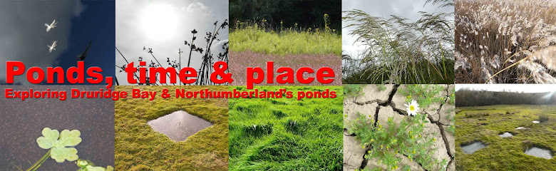
Most of our work focuses on Druridge Bay: monitoring how the
communities of invertebrates change over the years in ponds at Hauxley, how the
number of wetlands at Ellington Farm (the
new Crown Estates name for Blakemoor Farm) vary with rainfall and quantifying the
carbon capture across different pond types throughout the Bay. The ponds and
wetlands certainly bury more carbon than the other habitats such as pasture or arable fields, but we need to
check if that holds true in different regions of the UK or else we can’t say much beyond
just the detail we have for Druridge. Pete and Scott have been venturing further
afield, first to the Lizard Peninsular in Devon where many of the wetlands are
technically Mediterranean, at least in their plant life. Last week Pete was down
in Yorkshire, with the Yorkshire Wildlife Trust taking sediment cores from small
ponds on Askham Bog. The Bog is on the outskirts of York, and has long been
used for peat digging and livestock, but retains a mysterious feel, especially
amongst the denser scrub where a wrong turning can have you face to face with half
wild horses. I don’t know which half is wild, though when I met them a few years back the front ends
seemed plenty dangerous enough. Pete opted for cores from slightly less hazardous
terrain, distinctive small rectangular ponds, some inside an enclosure which
creates the undignified impression that he is a type of livestock.
The
pond’s origins are uncertain, with some suggestions that these may be peat
excavations going back as far as Roman York. The important criterion for
selecting these sites is their small size. We want to characterise the carbon dynamics
of smaller wetlands because these are the ones missing from carbon budgets,
although such wetlands are ubiquitous and numerous. The Lizard and Askham Bog
are lowland sites, to match the broad landscape of Druridge. We also plan to
include some sites in Norfolk, which should add a hotter, drier biogeography
into the mix. Lowland Northumberland, Yorkshire, Norfolk and Devon will make a
good start to capture the variation in carbon burial around the country. The differences between wetlands around Druridge
Bay is striking. Regional variations from cool northern, to hot southern should
only add to this mix
Monday, 2 March 2015
The hebridean inhabitants of Hauxley
Winter’s grip is loosening. The ground is still sodden, and scabbed
over with dead flower stems and grass blades barely green from the cold but the
air is full of bird song. The little birds have kicked off, finches and buntings, tree sparrows and wrens. Work
is well underway at Hauxley too, on the new straw build hide. The burning down
of the old hide turned out to be a blessing. It was a beautiful wooden
building, substantial and snug. I still treasure the strange grand opening breakfast
as the great and the good of respectable Northumberland squeezed into its main
room for scrambled eggs and bacon. With so many more people coming to Hauxley
it rapidly became obvious that a bigger building would be better with
classrooms and a cafe so that the bacon and eggs were not a one off.
The western edge of the reserve has been enlarged too now,
following a land purchase and a flock of pretty Hebridean sheep are now at work
grazing, or they would be if they did not follow any passer- by in the hope of
a feed. They have the deepest brown wool, fluffed up akin to a Cruft’s poodle
and propelled on delicate legs so that from a distance they appear to be
animated woollen bobbles that have come adrift from a hat. The new land is
largely stark grassland, but like so much nature conservation think ten or
twenty years ahead. New woodland and scrub will form a rich fringe to the
reserve and hopefully saline grassland can take over the inundated edges. Room
for some new ponds too, perhaps larger, permanent ones in contrast to the
shallow flashes and pools that already ring the car park. A mix is best. The
winter flashes around the car park area riot of summer flowers but some deeper
ponds would be good for submerged species such as Potamogeton pondweeds. Meantime the JCB started work levelling and
preparing the brow where the old hide was incinerated. You can check progress
on the Wildlife Trust’s special straw build Facebook group; the videos may by
students from Hirst Park Middle school are a joy. Here’s the link https://www.facebook.com/HauxleyNatureReserve
Subscribe to:
Posts (Atom)